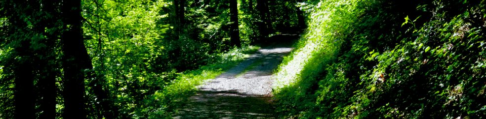
In Between?

Are you in between? That’s your affair–not mine.

Pumpkin, Butterscotch and Caramel Sno-Cone

The first snow fell and autumn color had not finished–in between fall and winter.

And my friend CJ has always been in between–in between cultures. See for yourself: Tangier Gardens at https://amzn.to/3HLrtyv

“The Landscape Architect” Series–update

CJ was in Morocco during Tangier Gardens and Curious Tales, the first two books in The Landscape Architect Series, which now have been published.

The next two books have CJ in Saudi Arabia, Thailand, Switzerland and Egypt…BUT

…springtime in these Swiss mountains and lakes has been so enchanting that I have had to go outside and walk and walk and walk. My novels suffer. Yenbo Palms and Crystal Vision will be published before the end of this year.

Please sign up on my email list for pre-release details and discounts. Thank you.

Mountain Stream

The flow.

Mountain stream above the tree line, clear and white–straight flow to the pineal.

The stream takes advantage of the eyes and ears as paths to the pineal.

Words and talking get in the way–the stream continues; but the pineal flow stops.

~~~~~~

In Tangier Gardens, CJ discovered this flow.

He didn’t know what to call his experiences, paranormal, gnostic portals, or the answers to existential unknowns–but he knew the inputs were from nature, its landscapes and plants.

Want to learn more about these experiences in nature, in the landscape? Please join my email list.

Treeline in the mirror

Which photo has the treeline?

1. No treeline, the mountain is not high enough.
2. Treeline, the line above which trees no longer grow.

So, what is a tree line?

Well, Wikipedia can tell you; but the mountains I am looking at are in Switzerland so I’ll refer to the Department of Geography at the University of Zurich for the definition of a treeline.

A mountain treeline certainly is not a line in the common sense. The treeline is defined as the high elevation, climate driven limit of tree growth.

The treeline is the edge of the habitat at which trees are capable of growing. It is found at high elevations. Beyond the tree line, trees cannot tolerate the environmental conditions (usually cold temperatures, extreme snowpack, or associated lack of available moisture).

It is easy to get into the weeds discussing the geographical, botanical and topographical details of a treeline. Just look at the images above for a general idea and the graphic below for a summary.

Mountain treeline explained

But where does the mirror fit in?

A treeline is natural. It tells about interactions between ecotypes. And that makes me think. Is the treeline a vector or raster. Is it a thin line, a narrow path one pixel wide or is it a broad and wide line with varying gradients, blurs and opacities?

I think the latter. And looking in the mirror at treelines, I wonder…are human cultures like environmental ecotypes? Are they definable on their edges by lines? Raster or vector? Is diversity our strength…or our weakness…or is the effort to define cultural differences a non-sequitur?

***

In my book, Tangier Gardens, CJ faced incredible cultural challenges.

The Tangier gardens saved that young man from the relentless, brutal challenges issued by the northwest Africa landscape. It’s an intriguing story about culture, design and humans. 

Give it a go.

Spring primrose

Primula veris

Primrose joy in the mountains.

At 2,000 meters above sea level, in the northern range of the Swiss Alps, I rediscovered the spring joy I had experienced three weeks ago, albeit at 500 meters above sea level. The glory of walking mountainous landscapes.

This joy can be discovered anytime, anywhere.

This is a similar joy to that Christopher Janus experiences in the Mediterranean gardens and landscape of Tangier, Morocco. For CJ it was both muse and adversary. 

That is the story of Tangier Gardens.

Up the valley

I am a naive midwestern American kind of guy–born and raised in the suburbs of Detroit, Chicago, Cleveland–not really urban, not really rural. Farming has always been a mystery to this outsider. 

I had a view the other morning across the Brienzersee (+/-564meters above sea level). I could see that it was the time that farmers were making the first cut of pasture hay. Notice the yellow and brown patches which have just been cut . Adjacent to the yellow and brown are fully green pastures that have not been cut. Better seen in the following enlargements.
Note the fields just above the village. This is a mountain lake–the lake is a valley floor. The valley feels like an open bowl.
Hay pastures in the Berner Oberland Jungfrau Region of the Swiss Alps in late spring.
So, in the valley across the way, at about 560 meters above sea level, the first seasonal cutting of the pasture hay has begun.

Everything I encounter in this agricultural mountain landscape…naively captivates me.

Around my own home the first haycuts are already underway–there is the fragrance of a freshly cut lawn–we all have that familiar smell but the smell of freshly cut pasture hay? We had a couple good rains in May–all pastures were rich with grasses and wild flowers–the wild flowers went to seed first then the grasses–and as the grasses were going to seed in the first days of June we had a spell of sunny warm weather.

All the farmers down here at the valley bottom were out cutting their pastures. Fragrance at daytime and night time. They let the cut hay dry in the open fields for a couple days before binding it for later use as feed.

Before the cut.
The cut.
Cut and drying.
Bailed.

What does that have to do with ‘Up the valley’?

Well, everything in my topographical homeland was flat. Topography and its impact on life in the mountain landscape intrigues me. So, I took a walk up the valley–up the Lutschine River valley to a village named Gundlischwand (+/- 660 meters above sea level). That means uphill 100 meters–doesn’t sound like much does it? Couldn’t be further–amazing walk–here’s what happened. The valley changed. The topography changed. The plants changed.

The valley narrows. The mountains steepen. The walk not too strenuous at all–suitable for a suburban midwest American like me.
I love seeing how trees can make their home on the steepest of cliffs and the narrowest of flat ledges. They know how to adapt. Adapt.

I was going back in time.

In the mountains spring comes first at the low valley elevations. Then by the time spring comes to the higher elevations it is normally not days but weeks later. 

So when I walked up the valley I was walking back in time. Climatically speaking.

The price of admission?

A stuffy nose, a couple sneezes and a runny nose–all in sequence.

It took me 1/2 hour to walk the next 100 meters.

This is the edge of pasture some time before the haycut. 100 meters above where the haycut is occurring.
The wild flowers beckoned me.
Wild flowers well ahead of the grasses. Seed time not yet.
I was on a journey.
Finally, I arrived at Gundlischwand.
A village in an agricultural landscape in the mountains–mountains? Jungfrau Region, Berner Oberland, Swiss Alps.
Apple and walnut trees always close to the doorstep and kitchen.
Not far from the edge of town…a footpath into the dark forest…

But that will be a journey for another day.

Wilderswil

Part of what keeps me going into the landscape every day is how the people in the local towns and in their agriculture integrate at the smallest scale into the larger landscape. Wilderswil is an excellent example.

From my place I took two busses and in 10 minutes I was in Wilderswil Dorf–the center of the village.

IMG_2260

The Bears Hotel in the center of Wilderswil–this is downtown in the village. 2,700 people live in Wilderswil which is part of the Interlaken agglomeration(24,000 pop.).

After 5 more minutes walk I was at the edge of the village on a pedestrian path known in the local dialect as a wanderweg–a way for wandering through the landscape–journeys to the unknown.

ForestJourney

Wandering along a wanderweg.

After 15 minutes in thick mixed forest, a view of the larger landscape opened before me.

IMG_2252

The small scale agriculture sits at the base of steep forested mountains.

SmallScalein the Mountains

The valley floor is pasture for smaller agricultural holdings. The forest begins where the slope becomes too steep for pasture.

The small scale agriculture comes right to the edge of town.

Edge of Town

This is the kind of diversity that comes from hard work and returns healthy people.

The town people use every imaginable way to bring practical plants, gardens and small scale agriculture right to their doorstep.

Integrating

These are typical throughout the village–the owners encourage nature right up to their front door.

This last black and white photo, taken in 1952, shows Wilderswil at the mouth of the Saxeten Valley and river. This valley, while never gaining the reputation of the Lauterbrunnen and Grindelwald Valleys, has undeniable drama and magnificent landscape setting. These are the Berner Oberland.

1952

By Werner Friedli – This image is from the collection of the ETH-Bibliothek and has been published on Wikimedia Commons as part of a cooperation with Wikimedia CH. Corrections and additional information are welcome., CC BY-SA 4.0, https://commons.wikimedia.org/w/index.php?curid=59858775

Exotic

Nigh onto 10 years ago I had just finished 25 years building gardens and landscapes in the Arabian Sands. The Sands were my life. 

But be sure about this…the Sands are more than sand. 

To reflect the huge unknowns of the Sands, my blog banner became part of the enigma of the Sands. Exotic for a Midwestern American, you bet. But exotic is a 25cent tourism marketing adjective. The Sands are not.

Ten years have passed. I live in another exotic landscape, this time a mountain landscape. Ten years of explorations in this new landscape have enthralled me, so I am updating the blog banner.

Exotic? Borders on magic realism, neo-romanticism and eco-gothic. They are all alive and well in exotic landscapes. as are rarely predictable and always inspiring plants and gardens. Just take a walk, open your eyes and ears. Listen, feel, see, discover.

WP19Apr2017r

Old banner–the sands–always an enigma–sun but no soil or water.

flahertylandscape2021Update

New banner–the plentitude of soil and water.

Spot the difference

Two pics,

Same time,

Same place,

Spot the difference.

Swiss Alps, Berner Oberland, Jungfrau Region, 11AM, 2Apr2021–the difference? 2000 meters above sea level.

Swiss Alps, Berner Oberland, Jungfrau Region, 11AM, 2Apr2021–the difference? 600 meters above sea level.

Isn’t that amazing?

What are we sure about in this life?

The weather?

The coming of spring?

Taxes?

Death?

Daily concerns often are little more than a good ha-ha.

And this is heaven?

Aletsch Glacier

River of ice? Sea of ice?

Often I intuitively feel an inspirational link in my plants, gardens and landscape photos. That makes them easy to share.

But this day, this photo left me wordless, speechless, spellbound.

Then finally came some words. Geography, topography. I was standing at 4,000 meters above sea level, looking down upon 3,000 meters above sea level. Those are the Swiss Alps.

I thought of the Himalayas and Mt Everest at 7,000 and 8,000 meters above sea level. Twice as high as I was on the day.

This is the Aletsch Glacier and its tributaries in the Berner Oberland. They live just off the back side of the famous Jungfrau mountain, above Interlaken.

Measured in human terms, the scale is incomprehensible. Even with the alarmists’ passionate flogging of the ‘end of the world’ ‘global warming’, which over millennia comes and goes like the seasons of each year, this living glacial landscape measures 14 km in length.

Still leaves me speechless. Its beauty takes my breath away. So I share this photo.